


![]() woke up that morning exactly where I wanted to wake up. That might sound odd, but what I mean is that The Moss is a beautiful, mysterious place that seems to communicate distant, but present threats: "Step in the wrong spot and you'll not be found again." For those of us who appreciate the solitude of the trail, and whose imagination doesn't run too wild, it was a magnificent campsite.
woke up that morning exactly where I wanted to wake up. That might sound odd, but what I mean is that The Moss is a beautiful, mysterious place that seems to communicate distant, but present threats: "Step in the wrong spot and you'll not be found again." For those of us who appreciate the solitude of the trail, and whose imagination doesn't run too wild, it was a magnificent campsite.
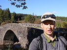
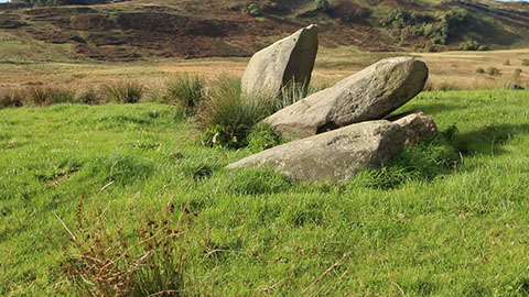
On a side note: I've seen the location of my campsite listed as "Ba' Bridge" on some maps and as "Ba Bridge" on others. I've stuck with the apostrophe for no other reason than that's the way I first saw it written. The word ba' with the apostrophe indicates a ball, a game using a ball, or a dance. The word ba with no apostrophe is a term for bellow or bleat (think sheep, "Baa"); which, I think, could make sense if it includes the bugling from the stags that I heard all night. Does anyone know the correct spelling?
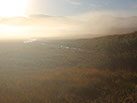
The previous night I had checked my progress on the maps and calculated that I needed to average a little over 10 miles each of the next three days. That's considerably less than the 16+ miles I had been doing each day. Knowing that, I took my time in the morning. A fog had arisen before I awoke and made the place even more atmospheric. I walked up and down the trail taking photos and videos. Now, it's probably obvious to many of you, I learned that walking through fog can be atmospheric, but it doesn't lend itself to photographs when you're standing in the middle of it. I returned to camp and allowed myself a deliberately slow pace for packing up.
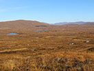
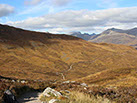
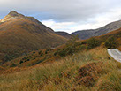
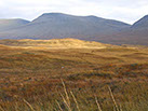
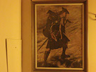
I broke camp at Ba' Bridge and headed for the ridge of Gualainn Liath Ghiuthias. I crossed that and entered Glen Coe. To the northeast was Rannoch Moor proper. This is another of the sights that I had longed to walk by. I had been by it several times on the A82, but that doesn't compare to approaching it from the trail. Rannoch Moor is even more desolate than The Moss; however, it had stirred my imagination since my early readings of Robert Louis Stevenson and my frequent viewings of my favorite painting in my parents' house, John Pettie's Disbanded. I paused here to enjoy the moment.
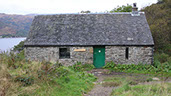
The West Highland Way took me by the Glencoe Ski Centre. I had a brief respite in this spot years ago to sample a dram of the newly released Penderyn malt with two friends. A good memory but I was more focused on Blackrock Cottage. This was, and is, one of the huts of the Ladies Scottish Climbing Club, established in the early 20th century. At the time, women's participation in activities such as hill-walking and climbing was frowned upon - they were too delicate and it would be too heavy a trial to their morals and good standing. The club is still active and the Blackrock Cottage stands as a testament to their trailblazing on the hills and with equality.
After a walk around the area I moved on, which required yet another, but my last, crossing of A82. I headed directly to King George Hotel. It was undergoing major renovation at the time of my walk so was there was not much to view. Perhaps a quarter mile up the trail I decided to pause for my first break. This was a shorter day so I was not concerned about taking a full 30-minute rest. However, I was now heading toward the Devil's Staircase and I wanted to hydrate and take in a few calories before taking it on.
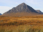
Not long after I was at the base of the Devil's Staircase. This is a climb to the col between Stob Mhic Mhartuin and Beinn Bheag. I live in the Pacific Northwest and my stomping ground is the Cascade Mountains - a brief climb like this would be a typical morning's walk. However, I let it get in my head that I had already walked 76 miles and my energy was probably drained. I chose to put my camera away and focus on the effort of walking. As it turned out it was a somewhat challenging, but quite achievable climb. I briefly regretted not having had my camera out as it was a beautifully clear day and the views were stunning. In the end, though, I have my memories of the place and I'm sure I'll be back again some time in the future.
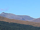
The ascent of the Devil's Staircase meant that I had left Glen Coe. I could now see Ben Nevis - Fort William and the northern terminus of the West Highland Way were at its base.


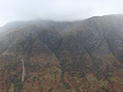
 Early morning fog drifts over The MossRannoch Moor. Robert Louis Stevenson wrote, "A wearier looking desert a man never saw." Also the site of a memorably brief visit in Trainspotting.Buachaille Etive MorApproaching Devil's Staircase - it's much steeper than it appears hereAt the top of Devil's Staircase - Ben Nevis in the distanceThe long road to KinlochlevenRiver Leven<>1 - 7
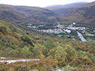
The next destination was Kinlochleven and my fifth night's camp. The trail to there follows old paths, military roads, and service roads. It was lovely in its own way, but not remarkable in history or world-class vistas. One interesting occurrence. As I was on the final stretch to Kinlochleven I came across two gentleman heading the other way, up the road, dragging an outfitted canoe riding on two small wheels. I spoke with them for a bit and they told me they were heading toward the reservoir for a day of trout fishing and an overnight camp. The younger gentleman was in his his twenties or early thirties and the older gentleman appeared to be in his fifties. I took them for father/son, uncle/nephew, or simply two friends of widely varying ages. Regardless of the relationship, the younger man was in front pulling the canoe up the steep slope while the older gentleman appeared perfectly content with his requirement of providing the occasional push.
I made my way down to Kinlochleven and found a suitable site for my camp. I had been carrying my Delorme inReach Explorer which provides for two-way text messaging via satellite. It's a good safety device. However, my guess is that I'm like most who have this device - it's primary use is for people back home. I can send a pre-porgrammed text that includes my current GPS coordinates. The person back home receiving the text can open it and it automatically opens a map showing them where I am. If people back home learn that they don't need to worry, then I'm much more likely to receive permission to go on other multi-day hikes in the future. The device worked flawlessly and I'm currently at home making plans for my next adventure.
![]() he early morning hours served as an example of how quickly you can habituate to different conditions and living standards when you're out on the trail for several days. I awoke at 4:30 am and knew I would not be falling back asleep any time soon. The weather was quite mild and pleasant. I decided to make good use of my time and wash my two hiking shirts - a short-sleeve polo and a long-sleeve wool hoodie (discontinued). I dipped them in the River Leven (water only, I don't use soap or other detergent on my clothes when wild camping). As I hung the two items to dry I decided it was warm enough to wash my hair. I found it surprising that I could comfortably wash my shirts and hair at 4:30 am on a mid-October morning in the Scottish Highlands. As stated, the temperature was mild and I was quite content walking around in the early morning air. Curiosity got the better of me and I decided to use the "weather forecast" feature on my Delorme inReach Explorer. It costs the equivalent of two texts - I have 40 texts as part of my monthly plan and was nowhere near my limit. The weather report was texted to me in a few minutes and, remarkably, it listed the air temperature as 42oF/5.5oC! Back home, I would have had a heavy shirt with a fleece on; here, after a few days on the trail I was comfortably walking around the campsite with shirts hung to dry, my hair wet, and feeling that it was a perfectly warm morning. Amazing how the body can acclimate so quickly.
he early morning hours served as an example of how quickly you can habituate to different conditions and living standards when you're out on the trail for several days. I awoke at 4:30 am and knew I would not be falling back asleep any time soon. The weather was quite mild and pleasant. I decided to make good use of my time and wash my two hiking shirts - a short-sleeve polo and a long-sleeve wool hoodie (discontinued). I dipped them in the River Leven (water only, I don't use soap or other detergent on my clothes when wild camping). As I hung the two items to dry I decided it was warm enough to wash my hair. I found it surprising that I could comfortably wash my shirts and hair at 4:30 am on a mid-October morning in the Scottish Highlands. As stated, the temperature was mild and I was quite content walking around in the early morning air. Curiosity got the better of me and I decided to use the "weather forecast" feature on my Delorme inReach Explorer. It costs the equivalent of two texts - I have 40 texts as part of my monthly plan and was nowhere near my limit. The weather report was texted to me in a few minutes and, remarkably, it listed the air temperature as 42oF/5.5oC! Back home, I would have had a heavy shirt with a fleece on; here, after a few days on the trail I was comfortably walking around the campsite with shirts hung to dry, my hair wet, and feeling that it was a perfectly warm morning. Amazing how the body can acclimate so quickly.
I allowed myself another slow morning. I returned to the Duomid. I pored over the maps, though studying every detail wasn't as necessary now that I was toward the end of the trail. I got up again around 6:00 am. As I stepped from my shelter there were three deer leisurely walking along the middle of the Leven. This was another moment when I wish I had my camera - but then there are quiet moments that are better left undisturbed and simply enjoyed.
The walk from Kinlochleven is immediately met by the climb up the side of Stob Coire na h-Eirghe to the old military road. The steep slope seemed a bit formidable at first until it occured to me that this would be the last real climb on the West Highland Way. Additionally, the trail provides several vantage points to look back down on the lovely villages of Kinlochleven and Kinlochmore.
The trail found the old military road and turned west. I would walk along this road for several miles. I came across several solo hikers and a couple of small groups. All were in cheerful moods - those heading my direction knew they were near the end while those heading the opposite direction were still benefiting from the excitement of the start of the trail.
Walking on old military roads in the Highlands is not technically challenging; however, the oddly shaped, definitively non-uniform cobblestones can be tiring on the feet and my soles were mildly sore. Nevertheless, I had no trouble managing all of it in my lightweight trail runners.
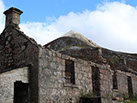
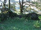
This west-running stretch of the trail travels the glen between Lochaber and The Mamores. It's a constant thread of dramatic Highland scenery. There's a ruined building situated at the approximate midpoint of this section. It's fairly well-known and frequently photographed with its B-list celebrity status likely due to the absence of any other photogenic objects (the general beauty of the Highlands notwithstanding, of course - sometimes the camera yearns for an anthropic subject).
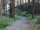
As I approached the turn to the north I passed through a tree plantation that had been clear cut. It was singularly ugly, but at these times I remind myself that the plantations can represent better environmental stewardship than ravaging second-growth and old-growth forest - not that there's much of those left in Scotland. In the recent past, these plantations tended to be planted with non-native trees which was not a good choice for the ecosystem. There's a growing movement toward devoting these plantations to native trees.


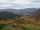 Looking back at KinlochlevenJoining the old military road as the trail passes the Mamores. The road is tough on the feet, but easy to follow.Tigh-na-sleubhaich, - one of the most photographed buildings on the WHW, probably because it's the only man-made structure in sightA harvested tree plantation. Ugly and often planted with non-native species, but it's an attempt at sustainabilityBen Nevis as seen from Dun DeardailThe Nevis ForestCow Hill with the northern side of Fort William peaking out beyond it<>1 - 7
I made the turn north and knew I was on the final stretch. Ben Nevis would soon dominate the view as I topped the shoulder of Mullach nan Coirean. This north stretch passes through the Nevis Forest, a dense, managed forest of mostly conifer woodland. I could hear the logging machinery in the distance and there were frequent warning signs to not step off the trail.
I had marked Dun Deardail Fort on my Ordnance Survey topo map. In general, I enjoy seeking out these iron-age structures. Some sites prove remarkable for having survived several thousand years. Others are in ruins and present as a collection of grass-covered rocks that I would not have known as either iron-age or man-made without the assistance of an interpretive sign. Dun Deardail was the latter. I'm not certain it was worth the steep climb to get to it. But, I had plenty of time that day and wrote it off as an extra bit of exercise.
I could have easily achieved Fort William that day. In fact, my friend was already at the B&B and I could have had a hot meal, a few pints, and slept in a warm bed. However, I had planned for six nights and was rather enjoying my time out in the Highlands. It was time to look for my last campsite of the walk.
This next caution should be obvious, but I do occasionally hear of ill-prepared campers who do not understand site selection. This section of the West Highland Way follows a forest service road. The forest is thickly wooded and the land is steep and uneven immediately off of the road. For long stretches the only level spots are the road and the passing places. Never set up camp in a passing place! It's a working road - there might only be two cars that pass in the night but if they meet at your passing place then that's the end of your wild-camping adventures.
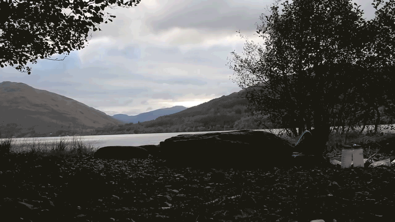
I set up camp much closer to Fort William than I had planned. In fact, I could see the Glen Nevis Road from one edge of my campsite. I had intended to camp deeper in the Nevis Forest, but didn't find a suitable campsite. This spot clearly was used many times before and was big enough to hold five or six groups. There was a small amount of trash, but, I suppose, not too bad considering it was so close to town. I cleaned up a bit and set up camp for my last night.
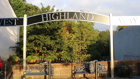
 he West Highland Way is a Long Distance Route between Milngavie and Fort William in Scotland. It runs for 154 kilometers (96 miles) and it is estimated that 80,000 people do a section of the route each year, 15,000 walk the entire trail. The West Highland Way was officially opened in 1980.
My plan to walk the West Highland Way came from a background of my father and his family telling stories of growing up in Scotland, an adolescent's imagination fueled by stories such as Rob Roy and David Balfour (Kidnapped), and previous trips through the Highlands.
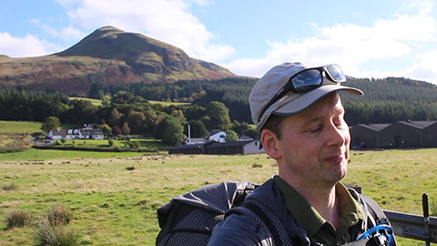
I wild camped the West Highland Way over seven nights. There's a video for each day along with a prologue. At each campsite along the West Highland Way I discussed and reviewed a category of gear.
Day 1: Milngavie to Conic Hill
Day 5: Ba' Bridge to Kinlochleven
Day 6: Kinlochleven to Cow Hill
Day 7: Short walk into Fort William
![]() woke up to the only "cold" I experienced on my 7-day walk. I put cold in quotes as it didn't require more than my 100-weight fleece; nevertheless, it was colder than anywhere else on the West Highland Way. I would guess the cold temperature was a result of the steep walls of the hollow dug by the Herive Burn - the sun didn't reach the campsite in the morning and a hollow will lose more temperature overnight than level ground.
woke up to the only "cold" I experienced on my 7-day walk. I put cold in quotes as it didn't require more than my 100-weight fleece; nevertheless, it was colder than anywhere else on the West Highland Way. I would guess the cold temperature was a result of the steep walls of the hollow dug by the Herive Burn - the sun didn't reach the campsite in the morning and a hollow will lose more temperature overnight than level ground.
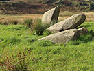
I had spotted St. Fillan's Priory on my OS map and it peaked my curiousity. Fillan possibly lived in the area circa 750 A.D., though the priory was not built until the 14th century. It's in ruins now but a few walls and foundations remain. There is an old church burial ground nearby with three (or perhaps just two?) medieval gravestones. You'll be able to find them if you take the time to explore the area.
There's a rather distressing story regarding the superstitions around healing associated with this place. People with chronic illnesses were taken to the nearby spring and dropped into the cold water. They were then brought to the church and tied to the altar. The invalid was then left there unattended and without food, water, and heat for 48 hours. If they were able to untie the knots and leave on their own they were considered to have been cured. If the person was still there (much the worse for wear, I'm sure) they were considered to still be ill and the process was repeated. In the context of the times this may have been considered state of the art, but I'm glad that we have moved well beyond that.
The next section of the West Highland Way was a pleasant stroll through Auchertyre. I crossed the A82 again and started a moderate climb through a forested hillside toward Tyndrum. There are some interpretive signs detailing clan history along the way.
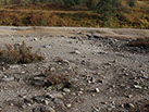
As I approached Tyndrum I came to an old lead mine. The mine is long-since closed, but the heavy metals and toxic processes have left the land devastated. The conditions for the miners had to have been horrific. This can be said of all mines in those times, certainly, but seeing the land laid waste many years after the mine had closed had an impact.
I passed through Tyndrum quickly as I wanted to get to the hills ahead to stop for a break. There was a public waste bin 100 yards down the road and I had a small collection of wrappers, ziploc bags (which had held my meals), and few bits of rubbish I picked up along the way. I didn't bother to make the short walk as I planned on dumping the trash after I had had lunch. Of course, I didn't see another public waste bin until Kinlochleven, 30 miles on. There may have been one in Bridge of Orchy, but I didn't see it.
I stopped for my late morning break on the west-facing slope of Creagan Glas. The views were opening up and I was frequently reminded of the beauty of this part of the Highlands. The trail generally parallels the rail line for a while and several Scotrail trains ran by. I don't know, in some places this would have bothered me, but here the trains seemed to fit well with the surroundings.
It was around this time that I stopped to have a blether with a friendly chap who was heading south. He had left two nights earlier and was doing the West Highland Way in 48 hours (or so) as a fundraiser. He was involved with a German Shepherd rescue group. He told me that he walked all night and passed Rannoch Moor and The Moss in the dark. It was rutting season and the stags were frequently bugling. He said they sounded like they were right next to him but were probably a fair distance away; however, it was dark and he didn't want to overuse his torch so he had no way of knowing. I was not able to find the link to this chap's charity group when I got back to civilization; if you happen to be reading this, then feel free to contact me.


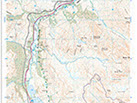 The road through EwichThe remains of St. Fillan's PrioryGravesite likely dating from the Medieval PeriodThe desolation at Tyndrum mineAncient caldera in the HighlandsBridge of OrchyThe solitude of the moor"Disbanded", long hanging in my parents' houseAlone on The MossA sample Ordnance Survery map with the north end of Loch Lomond<>1 - 10
I was soon at Bridge of Orchy. I took my 30-minute break behind the hotel and next to the bridge. In 2005 I had stopped there to make a phone call as an airline had lost my luggage. I used the pay phone outside the hotel as mobile phones were not ubiquitous then as they are now. It occurred to me that I was once again here with no mobile phone. I had abandoned the phone as I would have no need for it along the trail - it felt good.
I continued on to Inveroran and was caught off guard by the steep ascent immediately upon leaving Bridge of Orchy. The contour lines were on my topo map, but the steepness of the climb hadn't registered. I was soon beyond it, though, and looking at the little village of Inveroran. The village is dominated by the hotel and it is an attractively built building. My destination was a little further, however, as I wanted to maintain my pace.
The West Highland Way follows an old military road outside of Inveroran. The trail passes between several tree plantations as you approach The Moss. I'd like to take a moment hear to discuss water management. I carried the capacity for 3 full liters of water with my pack. My rule is that once I'm down to 1.5 liters I start to look for my next water supply - better safe than sorry. Well this rule definitely paid off here. It was the only place where I had to consider water management. There's plenty of water in this area, the problem is that you can't get to it or it's a thick sludge that would be preferable to not drink.
As it happened I was down to 1.5 liters as I was passing the first sizable tree plantation north of Inveroran. I was tempted to keep pushing on as the only water was small burns with banks that went 10 to 15 feet down. Common sense won the day (not always the case with me) and I made the climb down to the burn to replenish my supply. Good choice as there was no other water I could safely get to that day. Three liters is more than enough for me to use for hydration, dinner, breakfast, and some clean-up. I identified sources of water on the next day's maps and didn't have to worry about it. Water is plentiful on nearly all sections of the West Highland Way except for this one.
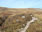
A couple of miles ahead was The Moss. It's a barren, desolate place and exactly the spot that I wanted to camp that night. It 's a bit mysterious, atmospheric, and, as the friendly chap had told me, the stags were bugling all night - it was perfect.
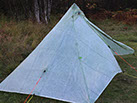
![]() his morning came with quite a surprise. Around 6 am I heard a noise I hadn't heard the entire trip - raindrops hitting the outside of my Duomid. The rain was quite light and lasted for not much more than 15 minutes. The true surprise is that this was the only rain I experienced on the walk!
his morning came with quite a surprise. Around 6 am I heard a noise I hadn't heard the entire trip - raindrops hitting the outside of my Duomid. The rain was quite light and lasted for not much more than 15 minutes. The true surprise is that this was the only rain I experienced on the walk!
I didn't plan to leave camp until 11 am. It would be a short walk into Fort William and I intended to arrive there about noontime; that way I could head to lunch if no one was around at the B&B. I had some clothes that were still clean as I hadn't needed them on the walk. Namely, I had a long-sleeve shirt and long pants. That kept me a bit more presentable than if I walked into town wearing my worn and torn hiking kit.
I broke camp down around 10 am and left at the intended time. There's not much to say about the last couple of miles of the West Highland Way. It follows sidewalks along major arterials into towns. It makes sense to finish the trail (or start for those heading south) near a major transportation hub, but it makes for an anti-climactic end.


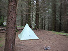
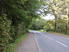
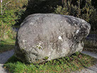
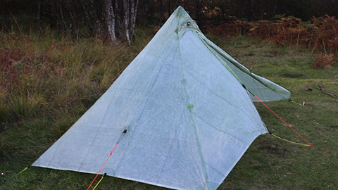
 This Duomid felt its only precipation for the entire trip a few hours earlier - about fifteen minutes of a light mistThe last stretch of the trail is not its most inspiringThe Wishing StoneThe end of the West Highland Way<>1 - 4
I stopped by the Wishing Stone, a large rock that has earned a few myths regarding magical powers, outside of town - after seven pint-free days in Scotland I had only one wish. A little later I was in town. As expected there was no answer at the B&B. I'd return later, but it was time for lunch. I settled in at the local Wetherspoon's pub, The Great Glen. It's a big place that easily accommodated my pack. I sat down to lunch and a pint of Deuchar's (or two...or three...).
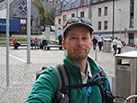
I'd be continuing on around Scotland for another couple of weeks. With that in front of me I had no feelings of melancholy having just completed the walk I had planned for so long. I now only had to find Mr Tattie Heid. We had made no plans other than we would be both in Fort William- no worries, we know each other well enough that we knew there would only be one place we'd be once evening starts to fall- The Grog and Gruel.

![]() houghts of walking the West Highland Way started a few years before the trip. About a year-and-a-half prior to departure I began to settle on specifics and logistics. In the twelve months leading up I began to create custom topographical maps, arrange the food and gear I would need along the trail, and secure airfare.
houghts of walking the West Highland Way started a few years before the trip. About a year-and-a-half prior to departure I began to settle on specifics and logistics. In the twelve months leading up I began to create custom topographical maps, arrange the food and gear I would need along the trail, and secure airfare.
![]() he trip got off to a great start thanks to the gracious and helpful hosts at Best Foot Forward B&B in Milngavie. A shout out as well to A2B Travel-Lite Baggage Transfer who smoothly handled a last minute change in arrangements.
he trip got off to a great start thanks to the gracious and helpful hosts at Best Foot Forward B&B in Milngavie. A shout out as well to A2B Travel-Lite Baggage Transfer who smoothly handled a last minute change in arrangements.
The day started with the departure from Milngavie through a variety of parks and trails. The West Highland Way is well-marked so no concerns about losing the trail. One of the first sites I was eager to see were the Dumgoyach standing stones - they're to the east of the trail and the side trip involved some very wet feet. I then walked by Glengoyne Distillery, but did not stop in (a first!). Later, I had a brief stop at the lovely little village of Gartness and had a futile attempt to spot the remains of a Roman fort, the most northerly in Scotland, but I'm fairly certain that what I saw was the mundane remains of a retired quarry.
I passed by Drymen not long after and was close to the end of my first day's walk. Passing through Queen Elizabeth Forest Park I had hoped
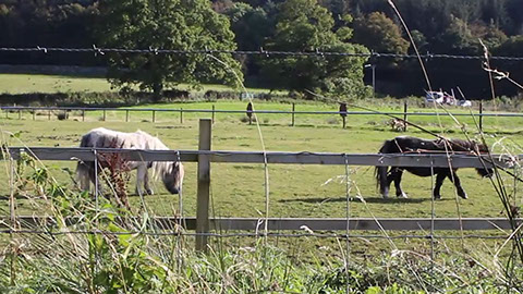
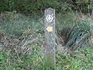
 The start of the West Highland Way in MilngavieThe waymark for the WHW. The trail is well-marked and you'll get to know this symbol well.The Dumgoyach (nearly) Standing StonesResisting the temptation of Glengoyne Distillery (in the background)Shetland poniesFirst camp at the base of Conic Hill<>1 - 6
to find St. Maha's Well, but that wasn't to be. Upon exiting the park I knew I would soon have to choose a campsite. I had a couple of hours of sunlight left; however, Conic Hill was quickly approaching. If I passed over that then I would enter the restricted-camping zone. There's no camping from the northwest side of Conic Hill to a few miles (approximately 9 miles, as I recall) up the shores of Loch Lomond - too far to cover in the time I had left. The camping restriction is due to misuse, abuse, and generally poor behavior of many campers along that section of the West Highland Way.
Still, I camped along the Highland Boundary Fault - can't complain about that.
![]() n early awakening around 6:30 am. Getting right out on the trail yesterday helped me adjust to the time difference (8 hours) more quickly than usual. My morning routine consisted of getting dressed - which includes the wet shoes and socks due to yesterday's stop at the standing stones, getting my drammach ready, taking down the Duomid, and packing all of my gear and clothing into the pack. It takes about an hour, but could be done much more quickly if needed.
n early awakening around 6:30 am. Getting right out on the trail yesterday helped me adjust to the time difference (8 hours) more quickly than usual. My morning routine consisted of getting dressed - which includes the wet shoes and socks due to yesterday's stop at the standing stones, getting my drammach ready, taking down the Duomid, and packing all of my gear and clothing into the pack. It takes about an hour, but could be done much more quickly if needed.
Today, I started at the southeast base of Conic Hill. Conic Hill, and specifically it's position as part of the Highland Boundary Fault, is one of primary sights I had long wanted to see on the West Highland Way. I quickly climbed the southeast slope and achieved the north face. It's from that vantage point that you have a magnificent view of the Highland Boundary Fault. This fault is the boundary between the Highlands (approximately 650-800 million years old) and the Lowlands (approximately 450 million years old). It runs from Aberdeen to beyond County Mayo in Ireland. It's a challenge to truly fathom that this entire area used to be well south of the equator, but that's what the geological record tells us.
Climbing down the west slope of Conic Hill I entered the restricted-camping zone. It was just touching mid-morning so I had plenty of hours to get myself well beyond this zone and back to wild camping. I took a break in Balmaha Plantation to finish my drammach. It was then a short walk to the village of Balmaha. Passing through the village was the only stretch on the entire West Highland Way that I found it difficult to find the way markers to stay on the trail. This was due to the parking lots and village center; however, it was a brief detour and I promptly spotted the next way marker ahead.
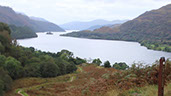
I touched my toes in the waters of Loch Lomond for the first time - this is Rob Roy country! I continued north along the shores of Lomond to Rowardennan. I had brought a topo map of Ben Lomond just in case I would be inspired to climb it. That turned out to not be the case. I likely had enough hours of daylight to summit and return back to the trail, but I was eager to get beyond the restricted-camping zone. I reached Ptarmigan Lodge, the end of that zone, just a little later. I likely could have done Ben Lomond, but I was happy knowing that I was now well beyond my goal for the day as far as progress along the trail.
I stopped to explore the remains of what I believe was Rowchoish. It was here that I realized I was spying Tarbert, the ancestral home of the Clan MacFarlane, across Loch Lomond.
I continued forward until I found a suitable campsite at Cailness. As I set up my camp I could see the clouds thinning and blue sky increasing - an indication of the spectacular weather I was going to have.
![]() chose the campsite based on fundamental factors such as flat ground, near the trail but distant enough for privacy, and proximity to a water source. It turned out to be much more than that. The clouds filtered away, the temperature was mild, and I could keep the flaps open on my Duomid. The soft waves of Loch Lomond provided a gentle chorus all night. The A82 was strangely hypnotic - too far away for me to hear it, but I could watch a slow march of red (tail lights) and white (head lights) float along the far shore. An entirely different experience from driving along the A82 during the day (just ask Mr Tattie Heid).
chose the campsite based on fundamental factors such as flat ground, near the trail but distant enough for privacy, and proximity to a water source. It turned out to be much more than that. The clouds filtered away, the temperature was mild, and I could keep the flaps open on my Duomid. The soft waves of Loch Lomond provided a gentle chorus all night. The A82 was strangely hypnotic - too far away for me to hear it, but I could watch a slow march of red (tail lights) and white (head lights) float along the far shore. An entirely different experience from driving along the A82 during the day (just ask Mr Tattie Heid).
I packed my camp and rejoined the trail. My aging eyes in the early morning light thought that Inversnaid was 1/4 mile north based on my reading of the map. It turned out to be a couple miles further than that, but no matter. A lovely spot. A tour group was walking through the grounds. A couple of older gentleman appeared to be reminiscing on a long-past military posting somewhere in the area. I was tempted to listen a little longer but decided it was more respectful to allow them their privacy.
Rob Roy's cave! Honestly, I hadn't given much thought to the place prior to the trip. I saw it listed on my topo map and decided it could be mildly interesting. It was right off the trail so why not spend a few minutes exploring.
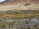
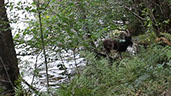
Thinking back, the section of the trail along the north half of Loch Lomond presents the most difficult walking of the West Highland Way. Perhaps the old military road outside of Kinlochleven comes close, but I found I needed to watch my feet the most along here. I don't mean to compare it to backcountry and off-trail hiking; but you should be prepared for tree roots, constant oddly-shaped stones that will do their best to trip you up, and a few small scrambles. There are other suprises as well. I was treading carefully and suddenly found myself in the middle of a herd of feral goats! They're not dangerous if you stick to your walking - don't attempt to feed them or take selfies.
Soon I left Loch Lomond behind me. It's a lovely, atmospheric section of the West Highland Way with opportunities to explore some history.
I made my way to the Doune Byre Bothy. It's a well-known bothy that is familiar to nearly all walkers along the trail. I was about to peek my head in when it occurred to me that I had not been inside a permanent man-made structure for the past 2.5 days - why not keep that going for the full trip? I moved on.


 Path to Rob Roy's CaveFeral goat along Loch LomondSaying goodbye to Loch LomondDoune Byre BothyA brief stop at Falloch FallsHighland coosCrianlarich - halfway mark of the West Highland Way<>1 - 7
I made my way down the north side of Cnap Mor and on toward River Falloch. As I walked through the cabins at Beinglas Farm I thought this would be a great overnight for young families and small groups. Not for me, though; I was enjoying the wild-camping experience.
Thirty minutes further north and I was at Glen Falloch. I had marked this on my map as my 3rd night camp and it was only mid-day - definitely pleased with my time. I should note that the designated campsites that I had put on my maps represented the minimal progress I needed to make each day. If I wasn't achieving these campsites then I would have to consider other alternatives, such as bagging the walk and getting some form of transportation. Fortunately, though, I was well ahead of schedule. I took my 30-minute break to eat some of my lunch and rest my feet with shoes and socks off - this is an obligatory practice for me when I'm doing multi-day hikes of 8+ hours.
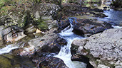
I got back on the trail after my rest. A little further on I came upon the Falls of Falloch - would have been a nicer spot for my rest, but no matter. Eventually, the trail crossed to the opposite side of the A82 - back to disliking that road.
The weather was now sunny and beautiful and would be so for the remainder of the walk. I was extremely fortunate to have such perfect weather at this time of year; however, the walk along the ridge to Crianlarich and Ewich Forest is exposed and it was hot. I stopped to apply more sun screen. I hadn't thought I would need much SPF at this time of year and now I was wondering if I would have enough.
I reached the edge of the forest and there was the sign marking the half-way point of the West Highland Way! I hadn't planned on reaching that milestone until well into the next day. I again felt pleased with my time and knowing I was halfway done with a great deal of time to spare allowed me to relax and focus on simply enjoying the walk.
I set up camp in the middle of Ewich Forest near Herive Burn. An odd thing happened later that night. I began to hear small explosions and peaked out from my Duomid. Someone was lighting off fireworks, I assume it was from in or around Crianlarich. Now, birthdays are not a big thing for me, but that day did happen to be my birthday. I spent a wonderful day walking along the trail and what's the harm in telling myself those fireworks were being set off in my honor?


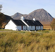
Blackrock Cottage in Glen Coe, one of the huts of The Ladies Scottish Climbing Club. This club was founded in 1908 at a time when women's participation in outdoor activities was discouraged. If these activities were undertaken then it was expected to be done under the supervision of men. The members of the club went on to blaze numerous trails and achieve first ascents. The club is the oldest continuing all-women mountaineering club in the world.